Showing posts with label bike adventure. Show all posts

Monday, November 26, 2012

Where's Craig?

I have a map of the United States… Actual size. It says, Scale: 1 mile = 1 mile. I spent last summer folding it. I hardly ever unroll it. People ask me where I live, and I say, E6.
—Steven Wright

I'm in Houston, TX, at my parents' house. I got here via train, which I got on at Maricopa, AZ and rode for twenty-nine hours till Houston. There, at the Amtrak station in downtown Houston, I unpacked my bike, loaded my panniers, and rode westward for fifty miles to where my parents live, which these days is no longer in the boonies due to the ever expanding sprawl of the Houston Metro Area.

Here I am at my apartment ready to leave for south Chandler. This is the first trip I've taken that uses all four panniers simultaneously, even though I've owned the bags for three years. Even with two weeks of stuff, I had a lot of spare capacity.

This is the second bike-and-train trip I've taken from Arizona to Texas, the first one having taken place four years ago during Christmastime after I learned about the thrift and ease with which bicycle transportation integrates with train travel. That trip began with me leaving my studio apartment on a cool December afternoon, shortly before sunset. I rode my heavily loaded LeMond bicycle south out of Phoenix, and by the time I arrived at the train station in the city of Maricopa, nearly forty miles away, the cool afternoon had become a cold night. Nevertheless, even after all that biking I was still two hours early. The train was scheduled to arrive at about midnight, and the station didn't open until two hours prior. At first I waited out in front of the station in the frigid desert air, occasionally donning more shirts—cotton over polypro over wool over polypro—until I ran out of extra shirts and traded freezing outside for loitering inside the convenience store across the highway.

Amtrak has since changed their schedule. Nowadays the eastbound train leaves Maricopa at 6:40 in the morning. The new time eliminates the problem of waiting around in the cold like last time, but it presents the new problem of getting to the station early enough. I knew I would need an hour to check-in and fit my bike into its box. Also, I live an extra half-hour farther away from Maricopa and thus need more time to get there. I briefly considered the scenario of leaving my apartment at 1:00 in the morning for the longest and latest night-ride of my life. Next I considered leaving the day before and spending the night cocooned in a sleeping bag along the side of the highway somewhere between Phoenix and Maricopa. But I settled on the best possible option: staying at a friend's house in south Chandler and waking up in cozy comfort at 3:30. I even got fed quinoa and beef and Jack Daniels the night before, which is much better than being food for coyotes or other Sonoran carnivores.

The train ride was uneventful. I remember four years ago being sociable, talking to the other passengers and, well, having a lot of fun. This time I kept to myself: I read, I worked on Project Euler problems on my laptop, I sat in the lounge car and watched the scenery pass by, and I slept. When the train came to a stop in Houston, I was happy to get off and eager to begin my third and final bike ride of my trip to my parents' house.

Monday, October 1, 2012

Cottonwood – Prescott Valley – Cottonwood

The shortest path between Cottonwood to Prescott Valley is the zig-zaggy AZ 89A, which passes through the town of Jerome before going up and over Mingus Mountain. Thursday last week I drove Laura's car to Cottonwood and biked the route as an out-and-back.

Those of you who don't live in Arizona likely have never heard of Jerome (jah-ROAM). It was established in the late 1800's as a mining town, and like many mining towns of that era, Jerome went through a cycle of extreme boom and a bust. According to its Wikipedia article, the town's population peaked at over 15,000 people in 1929 and plummeted to about 50 by the late 50's. Since that low, Jerome, like most other of the fortunate former mining towns, has reestablished its economy by eking out an existence based on tourism.

What makes Jerome stand out is its topography: it's built on the side of a mountain. As you pass along the switchbacks of its main street, past the numerous restaurants and art galleries, nearly every view gives a panorama of the Verde Valley over 1000ft below. My point-and-shoot camera can't capture the beauty and gradients of the town, so I settled for this photo of the street overlooked by the J on the mountainside above.

But my trip wasn't a tourist trip. It was a bike ride with an aim to do some climbing. The pass over Mingus Mountain is about 7000ft above sea level, Cottonwood is about 3400ft, and Prescott Valley is about 5000ft. I opted to start in Cottonwood (as opposed to Prescott Valley) so that I would do the big climb first and the big descent last. This strategy worked out well because by the time I made my second pass up and over the mountain, it was during the heat of the day, and I was looking forward to a cool, breezy descent down the mountain.

A frequently asked question about a bike ride like this is: How fast did you go down the mountain? In truth I don't know because my nifty high-tech Garmin GPS had a dead battery before I left the parking lot to start my ride. But for a ride like this—which took five hours, including a stop at a Subway to eat an egg-and-cheese omelet sandwich—nearly all the time is spent slowly cranking up the mountain and I enjoyed only a few minutes that seemed faster than they were on the way down. It's like eating a full plate of Brussels sprouts and then having one small bite of a cookie. But oh is that cookie a lot of fun.

Thursday, June 7, 2012

Mesa Verde National Park

This last weekend Laura and I took a road trip to Colorado. Though ostensibly the purpose of our trip was to visit Laura's cousin, Tim, in Durango, I had my own goal: to bike Mesa Verde National Park.

Mesa Verde is in the southwest part of the state, near Four Corners. It's mountainous and forested like central Colorado, but it's also dry like Arizona. A long time ago, when I was about ten years old, my family drove through the park, and somehow I got it in my head that I would return someday and bike it. Mission accomplished.

Near the campground there were many deer. I worried about colliding with one on a fast descent.

Higher up, there was a lot of beautiful, twisty-road scenery.

8572ft—This is the highest elevation I've ever ridden a bike. One of the benefits of not being in great form these days is that the thin air didn't bother me so much since I expected to suck a lot of wind. But I noticed the thin air on the descents—less air resistance means faster speeds!

Why yes, that is a cheap, frayed rubber band holding an expensive electronic gadget to my expensive bike. Your point?

The highlight of the ride wasn't the climbing or the descending or the scenery. It was going through this mountainside tunnel.

* * *

Though I had fun biking a small part of Colorado, the experience made me realize how good road biking in Arizona is. American civil engineering is about the same everywhere in the Continental 48, with the same 6% grades up and down mountains. Thus, the roads of Mesa Verde feel a lot like the roads in Phoenix's South Mountain park—only with thinner air and more motor traffic.

As for epic climbs, Arizona has many of those, too: Mt Graham, Mt Lemmon, Mingus Mountain—none of which I've yet biked. I think future adventures await me.

Monday, May 7, 2012

Four Peaks

Way back a month ago, during Easter weekend, I took a trip to Four Peaks. My goal was to ride up to the trailhead on Friday, camp the night, and hike to the top of Browns Summit Saturday morning before coasting all the way home on the bike. Goal not accomplished.


The stuff I packed—sans Nutmeg the Wondercat.


Packed up and almost ready to go.

Four peaks is east and a little north of town. My escape from the city entailed riding the same old roads, though I kept an eye out for oddities and new places to explore, being as how I had all day to ride a mere 100km.


Scottsdale tourists on elliptical-machine bicycles.


Detour!


Scottsdale: where bike paths look like miniature roads.


First view of Four Peaks, from the top of the Shea Blvd hill in Fountain Hills.

The weekend was especially hazy. In the photo above, Four Peaks is about 25 miles away as the crow flies. Most days it's clearly visible through the dry desert air, but this was not a weekend for stunning long-range photography.


Lunch! And dinner!


Riding the shoulder of the Beeline Hwy in the wide-open Sonoran Desert.


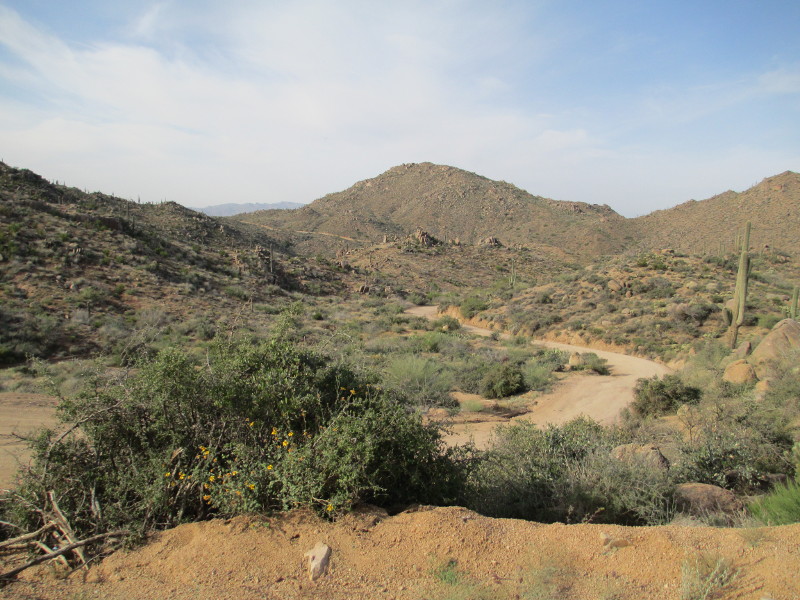
Tonto National Forest: a really big forest of, um, cacti.


The cacti look a lot healthier away from the lush city.


My earlier fears of getting lost in the desert were unfounded.

After a few hours riding through the city and an hour on the Beeline, I began the earnest part of this trip—the 20 miles of unpaved forest road up to the trailhead.


Forest Road 143: kinda like riding cobbles, I guess.

The forest road wasn't in as good of condition as I hoped—but it was better than I feared. Many sections of the road looked like the section in the photo above: hard, jutting rocks filling out the road's spine and a narrow, bumpy, washed-out strip of sand on each side. And steep.


Where's Waldo? Find the campers.


Heading south? Um?

For the hiking portion of the trip, I brought along my wrist compass. I thought I was clever to strap it to my bike's stem. But for some reason the compass thought my heavy, steel bike was always due north.


Forest Road 143 is a twisty one. But photos fail to capture the essence of gradients.


Notice the subtle changes in flora.


The only water I saw out there. Good thing I packed 2½ gallons on my way in.


Obvious change in flora—real grassland.


A big, cool-looking rock.


Was it the thinner air's effects on my brain, or was that rock on the right giving me the finger?

Maybe I should have trained for this ride. Shortly before reaching the top of the first climb, exhaustion surpassed pride while I passed a pickup truck going the other way. I waved down the driver and asked how much farther. “Oh, maybe another four or five miles. You'll see the peaks after cresting the next hill.” It was exactly what I needed to hear.


First climb done. Time to eat!

But as I ate my Veggie Delight sub, I gazed upon the valley between me and Four Peaks. I was going to ride across that down below? And then up that on the other side? I needed every Calorie of confidence the sub provided.


Snow!

The second climb, the one across the valley two photos above, was tough. And I was not prepared. The elevation, though only around 5000ft, got to me. The sandy, bumpy, washed-out road got to me. I climbed in my 26x34 granny gear—that's one-and-a-half pedal revolutions per wheel revolution. Any gear higher was too high. But the granny gear was causing my back tired to spin-out in the sand. So I had to stay seated to keep weight on the back wheel, while my legs were planning a strike.

I turned the cranks. One at a time. And then I couldn't anymore. I got off and pushed my bike. And when walking hurt more than riding, I got back on and rode. I switched riding and walking a few times, all the while the road went up, up, up—switchback by switchback. Eventually I gave up and promised myself I would stop at the next spot suitable for camping.


The top of Forest Road 143!

That next suitable stop turned out to be the top of Forest Road 143.

Now, my original plan was to ride to the trailhead. That was another mile or two farther—about another 500ft up a side road. No way. I was tired. I was nauseous. I was done. I set up camp where I was.


They put bike parking spots everywhere on this planet.


I camped on this side of the road. My food-containing pannier camped on the other side.

I arrived in late evening, and it got dark and cold fast. I put on my wool layers and slid inside my bag and bivy. I read for a while and then fell asleep.

I expected to spend a night isolated in quiet wilderness. But at night the ATVs came out. Lots of them. You hear them from miles away.

I woke up a lot during the night. First it was the ATVs. Then it was the penetrating cold. I have a slight claustrophobia and don't like to get too snug in a sleeping bag. But that night I zipped up the bag all the way and cinched the face hole as closed as it would go, and I zipped up the bivy all the way shut. Doubly trapped. But I was cold enough not to care.

When I woke up in the morning, having resolved the night before to nix the hike, I packed my stuff in a hurry so I could get off the mountain and away from the cold as soon as I could.


Balaclavas: warm and comfortable, but not stylish.


Leave no trace.


I had a long, winding ride down the mountain through the cold morning air.

Saturday morning brought out the boys with their toys.


Dirt bike.


ATV.


Mountain bike.

The mountain biker, above, stopped when I took his photo. He was laboring up the first climb on a single speed, on his way to the top of Forest Road 143 as training for the (then) upcoming race in Prescott.

He said he was having a lot of problems with his back tire spinning-out. Without a rear rack of weight over that wheel, and on a single speed with no granny gear, I imagined he was having a lot of problems with spin-out. But then he reached down and let out some of the air from of his rear tire. Then he clipped in and rode off, shouting back at me as he went, “Yeah, much better without all the air!” I felt like a moron.

Lesson learned: Don't climb on sand with a fully inflated rear tire.


More twisty, windiness.


Practice makes perfect.


Clean and green.


The highway! For once, I was happy to see a stop sign.

Back on the Beeline, I enjoyed the smoothness of the pavement and the ease of a down-sloping gradient with a tailwind. Of the twenty miles I was on the Beeline, I literally coasted with my elbows on the handlebars for about ten.


Burrito with a side of BPA. Yum.


A stop at Arizona Falls.

And that was my trip to Four Peaks.

Sunday, April 1, 2012

Shaw Butte

I began my 30 days of biking by fixing a flat tire. But the rest of day was better. I installed some new fatty tires on my touring bike and rode to the top of Shaw Butte.

Parked at the top amidst the radio towers.

I had never before been up Shaw Butte on a bike, mostly owing to the fact that I've never owned a mountain bike. As I pedaled up the steep grades, with my drop handlebars and my knob-less tires, I thought I was doing something heroic and maybe foolish. But after arriving at the top and striking up a conversation with a hiker, I was told a guy once rode to the top on a unicycle. So never mind on the heroism.

View on the way down. The radio towers of North Mountain, the finish of the LMI last weekend, are visible in the center background.

The descent didn't prove as technically challenging as I anticipated. The hardest part was preventing my hands from cramping, for I braked hard nearly the whole way down. You can't tell from the photo, but parts of the trail reach grades around 20%, and the terrain is sandy with largish, jagged rocks.

Once back on the desert floor, I rode to the North Mountain Visitor Center to refill my water bottle; then I rode trail 100 back to the safety and comfort of asphalt and rode home uneventfully.